Appearance
TREx NIR
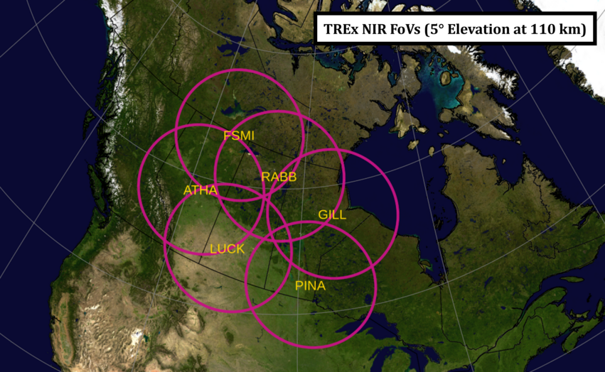
TREx-Near InfraRed (NIR) is part of the Canada Foundation for Innovation, Transition Region Explorer (TREx) sensor web. TREx-NIR is a narrow-band filtered (844.6 nm) ASIs deployed at 6 locations bracketing the Nightside Transition Region (NTR).
- 6 sensors
- Data tree location
- DOI details
- Acknowledgements PDF
- Contact: Emma Spanswick

View hi-res 5 degree elevation angle version
View 10 degree elevation angle version
View hi-res 10 degree elevation angle version
Observatories
Loading observatories ...
API Datasets
Common datasets:
TREX_NIR_RAWTREX_NIR_SKYMAP_IDLSAV
Loading datasets ...
Dataset Detailed Descriptions
TREX_NIR_RAW
The primary dataset used by the analysis support software, and the dataset that most users utilize.
TREX_NIR_GRID_MOSV001
Verified grid file dataset, version 001. Dataset generation details will be available shortly.

